
How to Read and Use MMCD Interactive Maps
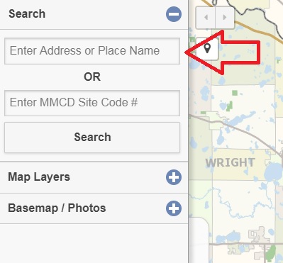
1) Enter a street address or place name to zoom in to your neighborhood.
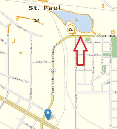
2) Click on a site outlined in orange to see information about that wet area, including its MMCD “sitecode” number and site type.
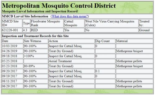
3) Click on the “Site Info” link in the information to see a detailed list of inspections and treatment (updated daily). On this page you will be able to see things like the date the site was last visited, what action was taken, and what materials were used.
- Note that ponds and lakes with fish or with no edge vegetation are not good habitat for mosquito larvae and do not need to be reported.
- Shallow, vegetated wet areas or storm water structures that hold water at least 5 days may produce mosquitoes; please let us know if these are not on our maps.
- Red sites are sites that produce a high number of human-biting floodwater mosquitoes.
- Yellow sites are sites that produce a moderate amount of human-biting mosquitoes and are second priority to red sites.
- Blue sites are sites that produce very few human-biting mosquitoes and are the lowest priority.
- Green sites are sites that are treated on a regular basis, usually monthly, due to their location in a densely populated area.
Comments? If you have comments or suggestions about our address lookup service, or any other feedback about MMCD’s website, please email us.
Disclaimer: These maps are intended as a guide only and are not jurisdictional wetland delineations. Metropolitan Mosquito Control District makes no representation or warranties, either expressed or implied, for the merchantability or fitness of any of the data for a particular purpose. Much of the data on this web site is made available through cooperation with other government agencies through MetroGIS. Multiple data downloads, screen scraping, or other computer extraction techniques are strictly prohibited. Metropolitan Mosquito Control District reserves the right to deny access to the site to any individual or party found to be misusing the site.